Ryde Harbour
Ryde Marina is located on the northeast coast of the Isle of Wight and enjoys excellent views across the Solent towards Portsmouth. The well-situated marina is protected from adverse weather conditions from most directions.
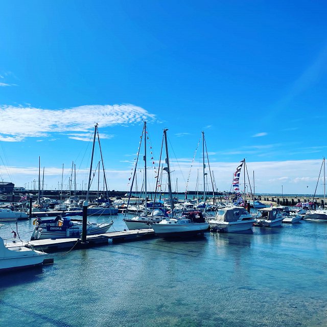
Image Credit: Ryde Marina
Ryde is known as ‘the gateway to the Island’ and, year-on-year, proves to be a very popular destination for families. Ryde Marina lies next to long sandy beaches where you can hire everything you need for a day on the beach, as well as kayak and paddleboard hire. It is only minutes away from an excellent selection of restaurants, a bowling alley, swimming pool and a host of other facilities.
While the marina does dry it remains accessible to vessels approximately 2 hours before and 2 hours after High Water Portsmouth for a boat drawing 1.5M. Ryde Marina Operatives can be contacted on VHF Ch. 80 Call Sign ‘Ryde Marina’ and will provide directions and assist in berthing your vessel. There is pontoon berthing for vessels for up to about 14 metres in length, there is the option for fin keel vessels to lay alongside the marina wall.
Approaching Ryde Marina from the east either pass north of No Man’s Land Fort or use the inshore passage between the fort and Ryde Sands beacons (lit port hand markers). Three Starboard hand markers and three Port hand marker mark the drying demarcation channel at 197º across Ryde Sands; these are unlit buoys. Keep well clear of the hovercraft manoeuvring between Ryde Pier and the marina, and the Wightlink high-speed ferries from and to Ryde Pier Head.
The Marina entrance is lit after sunset by two fixed red lights (vertical) on the port side of the marina entrance, and one flashing green light on the starboard side of the marina entrance.
Marina facilities include showers and toilets, water on all pontoons, electric hook ups, waste and recycling facilities, and a public slipway. Mariners are advised that the marina entrance suffers from a periodic build-up of sand and so before visiting should consult the latest navigational notices issued by KHM (Portsmouth). VHF Ch. 80 Call Sign ‘Ryde Marina’. There are also Local Notice To Mariners posted on the Ryde Marina webpage via www.ryde-marina.co.uk
Contact: Ryde Marina, The Esplanade, Ryde, Isle of Wight, PO33 1JA. Tel: 01983 613879 or 07512 578334 Email: rydemarina@rydetowncouncil.gov.uk
Please note, information in this publication is to be used as a guide only and not for navigation.